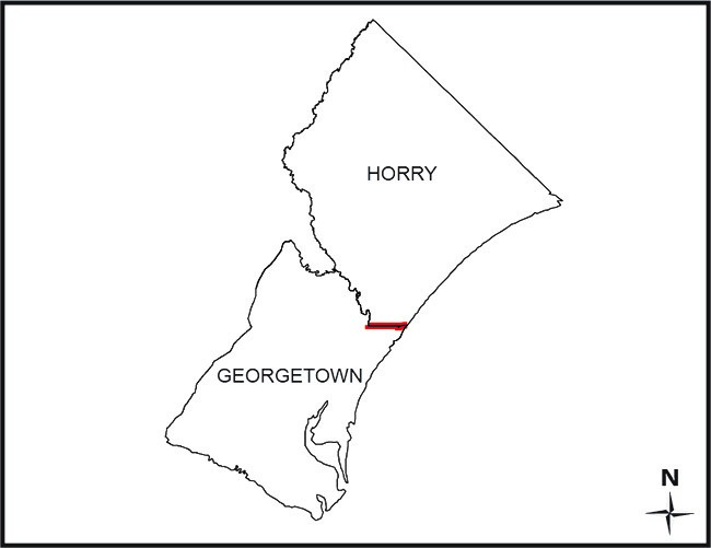
SECTION 4-3-270. Georgetown County.
“…center line of the Waccamaw River to a point at latitude 33° 34' 22.623" N, longitude 79° 06' 03.848" W (North American Datum 1983); thence eastward following a straight line to a point at latitude 33° 34' 21.602" N, longitude 79° 00' 06.564" W (North American Datum 1983) on the seashore; thence on a true azimuth of 126° (bearing of S 54° E) to the Territorial Sea boundary…”
SECTION 4-3-310. Horry County.
“…center line of the Waccamaw River to a point at latitude 33° 34' 22.623" N, longitude 79° 06' 03.848" W (North American Datum 1983) in the Waccamaw River; thence eastward following a straight line to a point at latitude 33° 34' 21.602" N, longitude 79° 00' 06.564" W (North American Datum 1983) on the seashore; thence on a true azimuth of 126° (bearing of S 54° E) to the Territorial Sea boundary…”
SECTION 4-3-311. Defined area of Georgetown County annexed by Horry County.
“…Beginning at the intersection of the Horry-Georgetown County line and the canal which runs from Horry County into Georgetown County to the intersection of Murrells Inlet Creek, thence northeasterly along the center line of Murrells Inlet Creek to its intersection with the Horry-Georgetown County line…This tract measures and contains 18.42 acres of land, more or less, and is clearly shown on a plat by William F. Cox, William N. Kellahan, Jr., and Samuel H. Hanna III, dated July 19, 2002, and filed with the Secretary of State on August 15, 2002…”
Read full unannotated text here
SECTION 4-3-312. Horry County; Georgetown County area transferred to Horry County.
(A) The following described portion of Georgetown County is transferred and annexed to Horry County:
"All that certain piece, parcel, or tract of land consisting of 210.32 acres or 0.3286 square miles described as commencing at a point in the center of the Waccamaw River, being that point defined in Sections 4-3-270, 4-3-310, and 4-3-311, Code of Laws of South Carolina, 1976, as amended, at Latitude 33° 34' 22.623" N, Longitude 79° 06' 03.848" W (North American Datum 1983), this being the same point positioned at Latitude N 33° 34' 22.6126", Longitude W 79° 06' 03.8429" (North American Datum 1983/2011) on the below referenced plat, and thence running along the Statutory Boundary for Georgetown and Horry counties N 89° 06' 55" E for a distance of 4,165.38 feet to a calculated point labeled 'B', this being the Point of Beginning: From the Point of Beginning, a point labeled 'B' and thence running along a line through points labeled 'B' through 'AR' on the Proposed Boundary Line for Georgetown and Horry counties, 'AR' being on the Statutory Boundary of Georgetown and Horry counties thence turning and running S 89° 06' 55" W for a distance of 23,067.40 feet along the Statutory Boundary of Georgetown and Horry counties to the calculated point labeled 'B', the Point of Beginning. Reference is made to this plat for a more complete and accurate description of the metes, bounds, and location of this property."
(B) This tract measures and contains 210.32 acres of land or 0.3286 square miles, more or less, and is clearly shown on a "Plat of a Portion of Georgetown County Proposed to be Annexed to Horry County", by South Carolina Geodetic Survey, AECOM, and Glenn Associates Surveying, Inc., dated January 9, 2019, and signed and sealed by David K. Ballard PLS#26946, Jason M. Forsberg PLS#28135, and Michael R. Mills PLS#11606 on January 17, 2019, and recorded with the Horry County Registrar of Deeds in Plat Book 287, Page 153.
- Folder Containing .dbf .idx .prj .shp .shx FilesFile contains the updated 2019 annexation boundary between Georgetown and Horry Counties and the 2003 waterway-based boundary annexation of Mt. Gilead Peninsula
- Survey of that portion of Mt. Gilead development situated in Georgetown County for the commission appointed by the Governor of South Carolina to investigate proposed annexation into Horry County, survey and plat by Lower Florence County Surveying, Dated J
Disclaimer
The Revenue and Fiscal Affairs Office is providing access to these materials for educational and research purposes and is not aware of any U.S. copyright protection (see Title 17 of the United States Code) or any other restrictions in the provided materials.
Note that the written permission of the copyright owners and/or other rights holders (such as publicity and/or privacy rights) is required for distribution, reproduction, or other use of protected items beyond that allowed by fair use or other statutory exemptions. Responsibility for making an independent legal assessment of an item and securing any necessary permissions ultimately rests with persons desiring to use the item.